700 villages in Assam, India will be mapped through drones
These unmapped villages have posed hurdles in executing government projects and land buying and selling

In India, the Assam government has launched drones to map 700 odd villages, which could help in demarcating borders with other states in the region in the future, reported ET Realty.com.
There are around 22,724 villages in Assam, of which 700 had not been mapped and caused problems in executing government projects, as well as the buying and selling of land.
In collaboration with Survey of India, the project started this week at No.1 Singimari village under Hajo revenue circle in lower Assam’s Kamrup district.
Once inter-state border disagreements settle down, drones will also demarcate the orders of frontier villages once for all, government sources reported.
Pankaj Chakravarty, principal of Assam Survey & Settlement Training Centre, said, “Once the pilot project in Singimari is over, there will be a massive mapping exercise in Dibrugarh and Tinsukia where the target is to map about 600 revenue villages.”
Dibrugarh and Tinsukia both have villages that are inhabited by communities and ethnic tribes but have remained unmapped for decades.
“Without maps, boundaries are incomplete,” he added.
While the exercise drones are provided for by the Survey of India, the rest of the work is being done by the Kamrup administration and Assam survey.
More: Indian developers redesign and digitalise office spaces with tech solutions
In the 1960s and 70s, maps of a large number of villages were prepared in the state through the conventional model, but several hundred remain undone.
A government source said, “Though survey pillars are lacking in many inter-district, inter-state and international borders in Assam, the plan in the future is to erect these crucial demarcation pillars with a scientific drone survey. But a lot depends on the goodwill of bordering states.”
The Property Report editors wrote this article. For more information, email: [email protected].
Recommended

Young buyers hold the key to unlocking Bangkok’s empty homes
The Thai capital's skyline still rises, but the market seems out of sync with its next generation of buyers
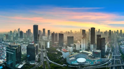
Investors double down on Jakarta despite Nusantara’s political rise
Density, demand, and capital flows continue to anchor real estate momentum in Greater Jakarta
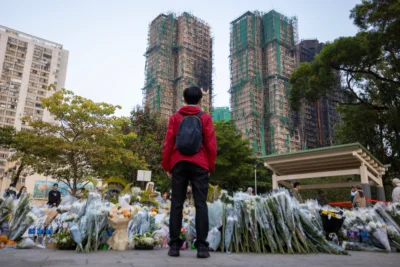
Hong Kong’s deadliest blaze in decades triggers stricter safety rules
But enforcement is the real test

A conversation with ThirdHome founder Wade Shealy
How luxury exchange reshapes home ownership, travel, and asset use